[ad_1]
INDIANAPOLIS (WISH) — Here is the latest on the severe weather late Tuesday afternoon and evening in Indiana.
6:51 p.m.
Indiana is no longer under any tornado warnings, Storm Track 8 Chief Meteorologist Ashley Brown reports.
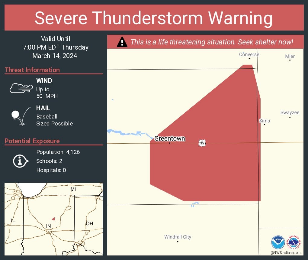
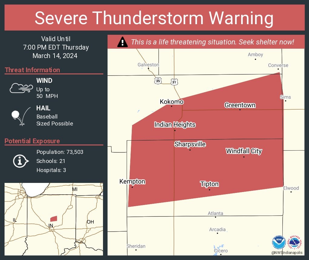
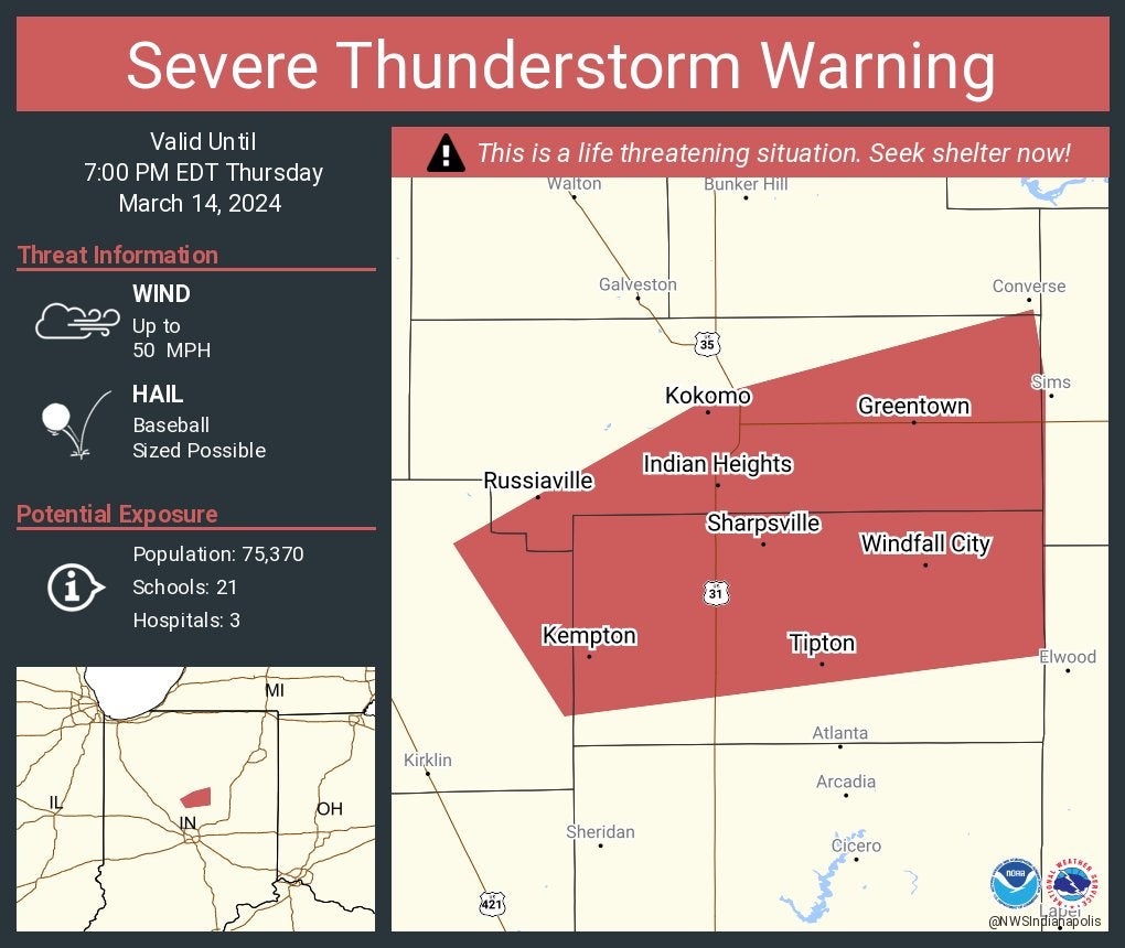
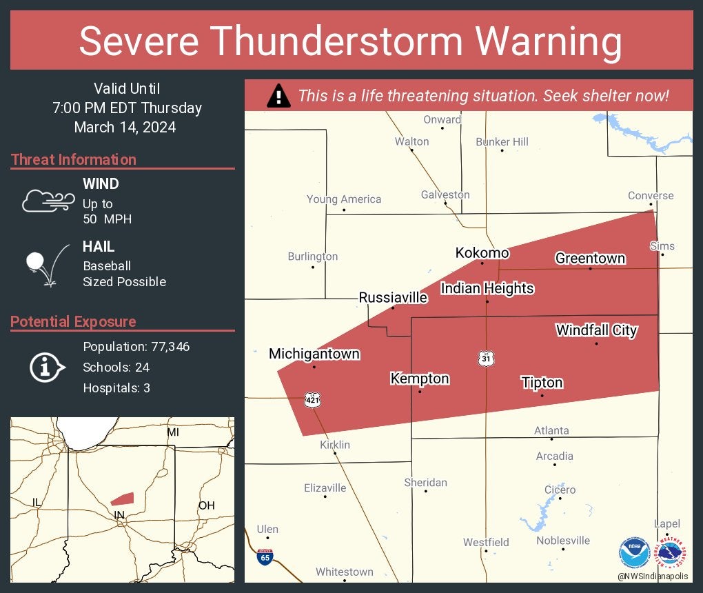
A severe thunderstorm warning for Tipton County until 7 p.m. The storm contains baseball-sized hail.
6:50 p.m.
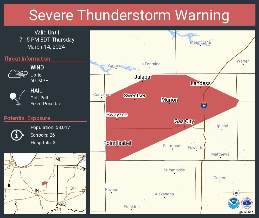
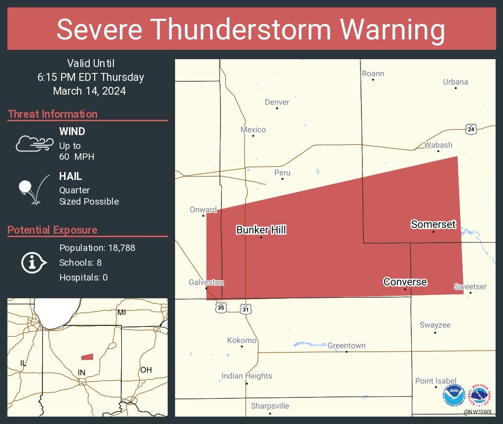
Severe thunderstorm warning for Grant County until 7:15 p.m. The storm contains golf ball-sized hail.
6:44 p.m.
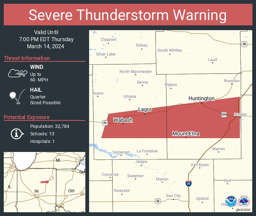
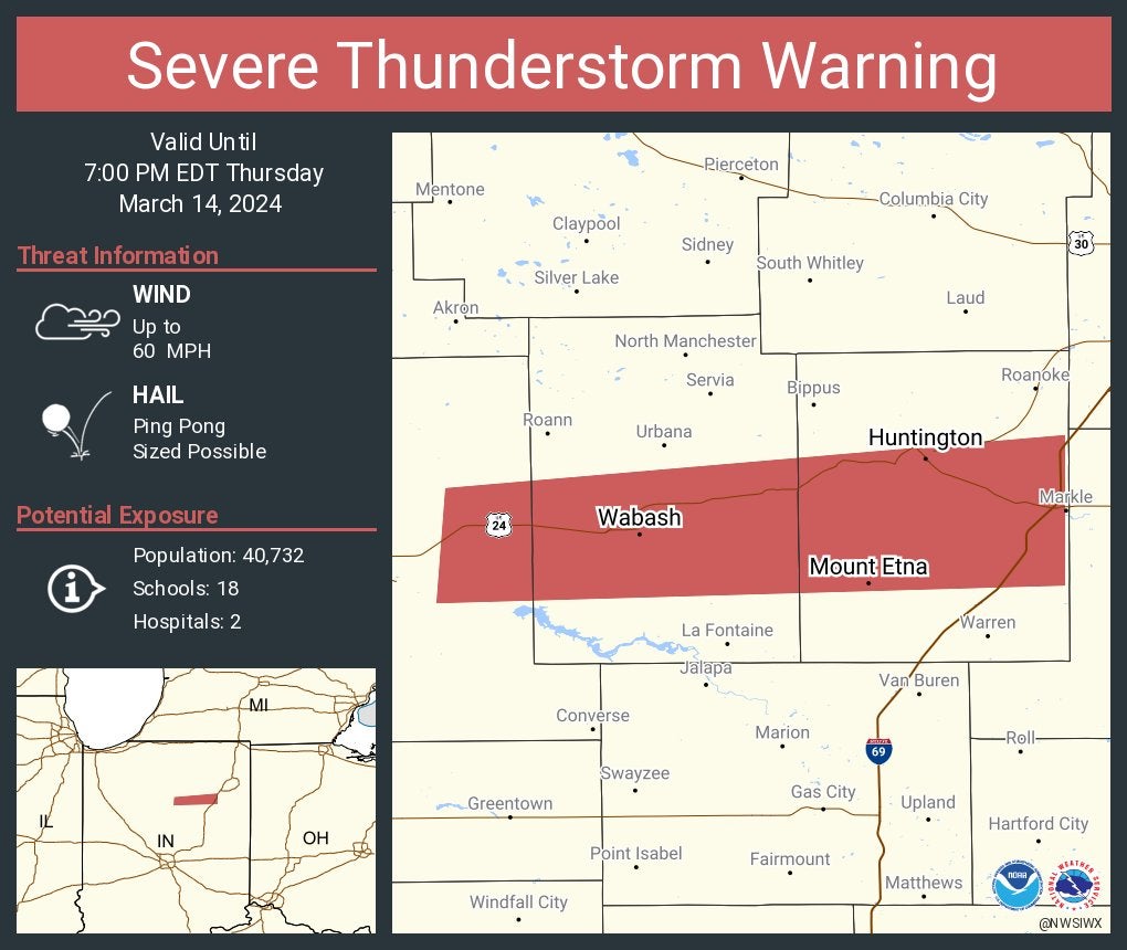
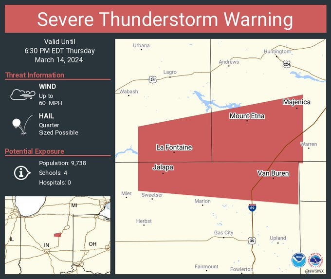
Severe thunderstorm warning for Huntington and Wabash counties until 7 p.m.
6:43 p.m.
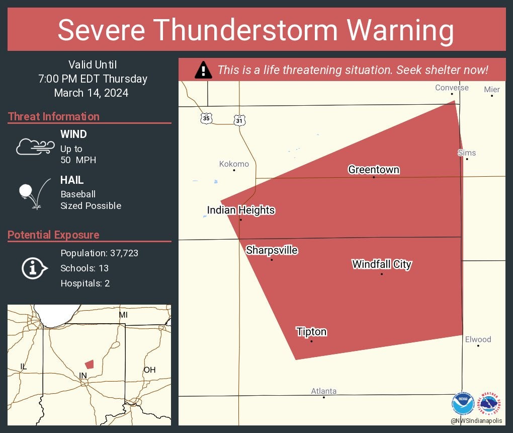
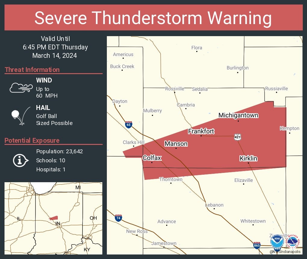
Severe thunderstorm warning for Howard and Tipton counties until 7 p.m. The storm contains baseball-sized hail.
6:42 p.m.
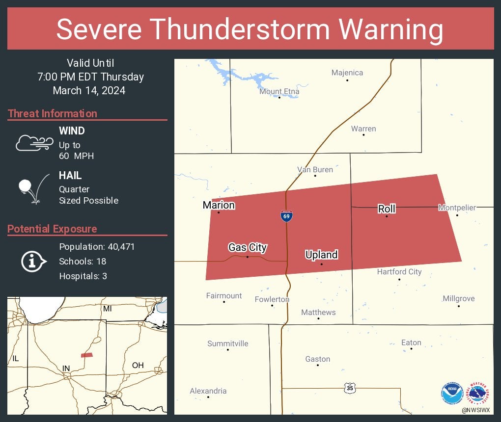
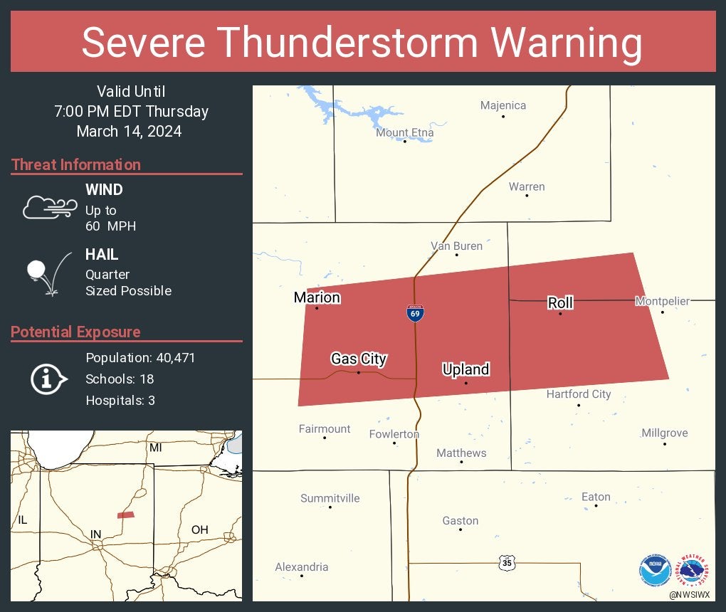
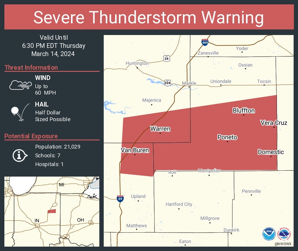
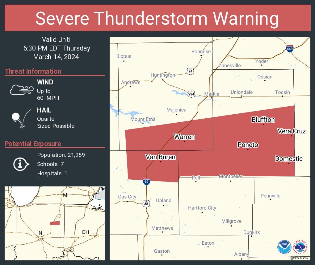
Severe thunderstorm warning for Blackford, Grant and Wells counties until 7 p.m.
6:39 p.m.
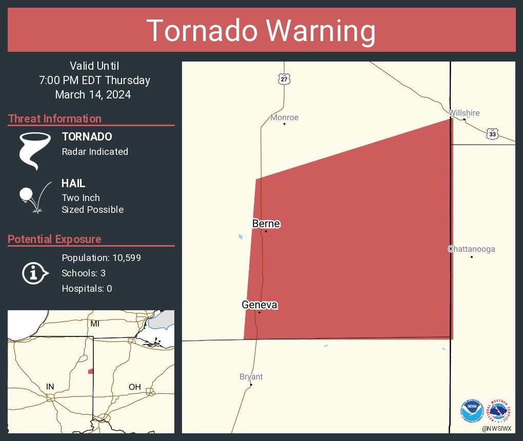
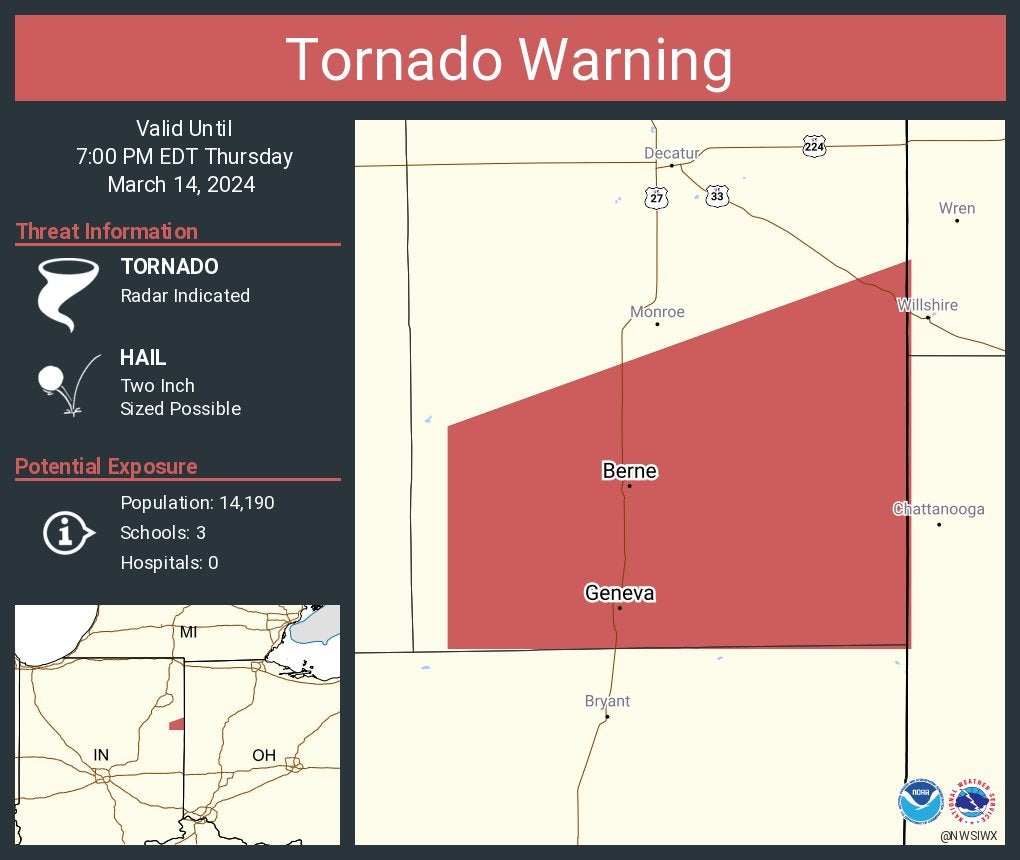
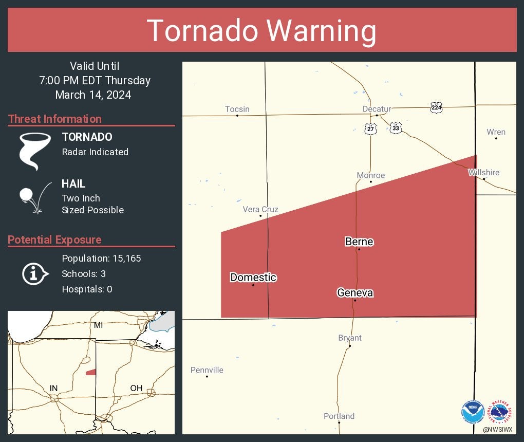
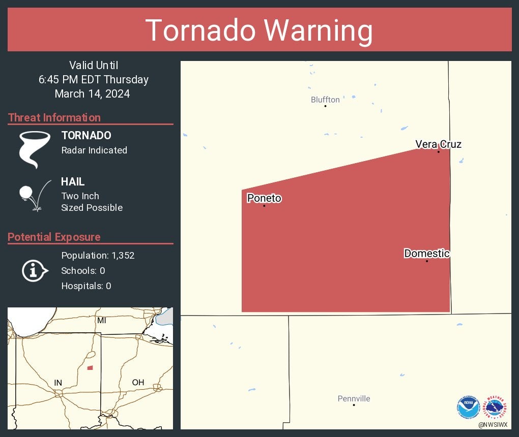
Tornado warning for Adams County until 7 p.m.
6:37 p.m.
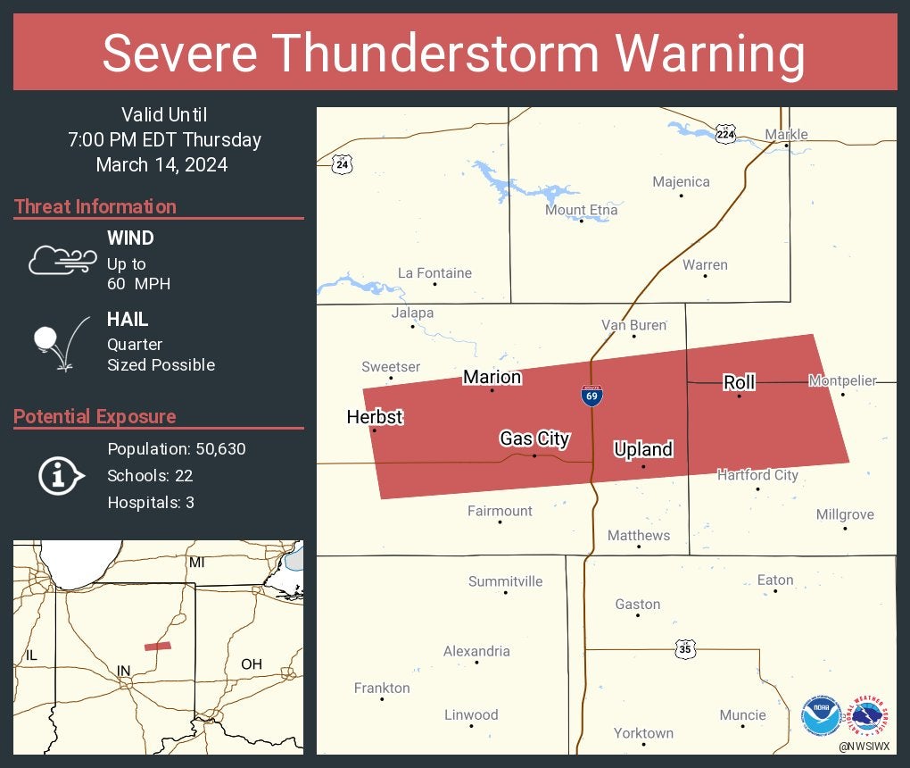
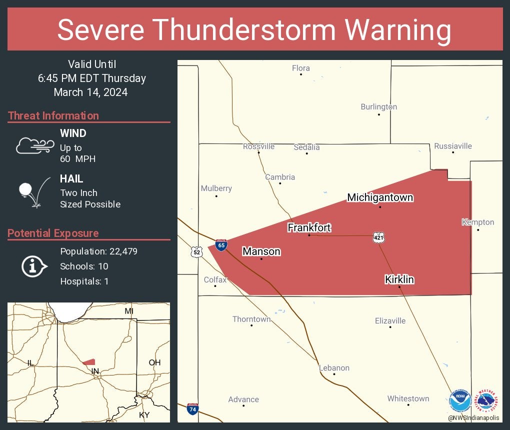
Severe thunderstorm warning for Clinton, Howard and Tipton counties until 7 p.m. The storm contains baseball-sized hail.
6:34 p.m.
Severe thunderstorm warning for Blackford, Grant and Wells counties until 7 p.m.
6:33 p.m.
Tornado warning for Adams County until 7 p.m.
Severe thunderstorm warning For Clinton, Howard and Tipton counties until 7 p.m. The storm contains baseball-sized hail.
6:31 p.m.
Severe thunderstorm warning for Miami, Huntington and Wabash counties until 7 p.m.
6:27 p.m.
Tornado warning for Adams and Wells counties until 7 p.m.
6:24 p.m.
Severe thunderstorm warning for Blackford, Grant and Wells counties until 7 p.m.
6:23 p.m.
Severe thunderstorm warning for Clinton, Howard and Tipton counties until 7 p.m.
6:22 p.m.
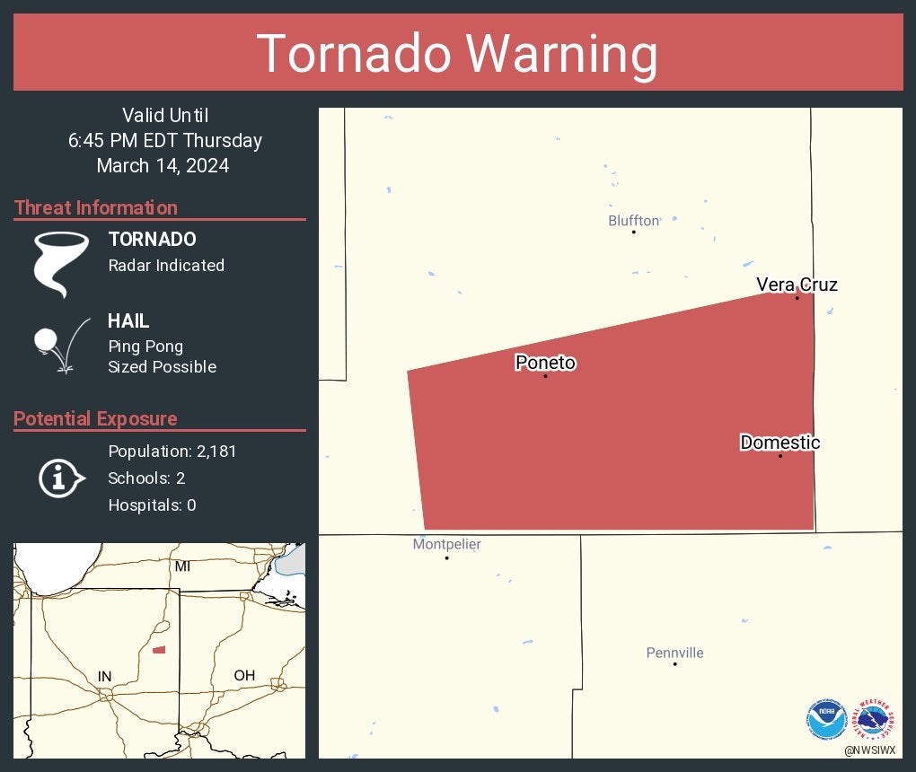
Tornado warning for Wells County until 6:45 p.m.
6:17 p.m.
A severe thunderstorm warning for northeastern Grant and southern Huntington counties until 6:30 p.m.
6:16 p.m.
Severe thunderstorm warning for Tipton County until 6:45 p.m.
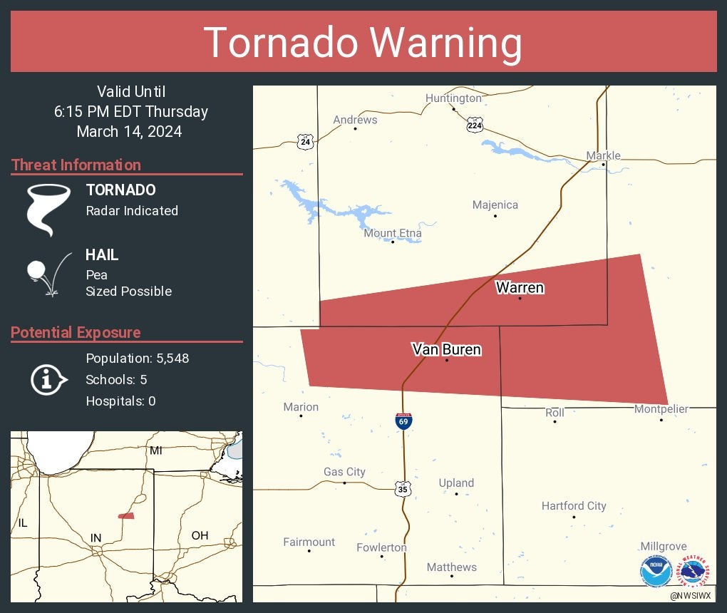
6:15 p.m.
A tornado warning for southern Wells County until 6:45 p.m. Ping-pong ball-sized hail is possible.
6:10 p.m.
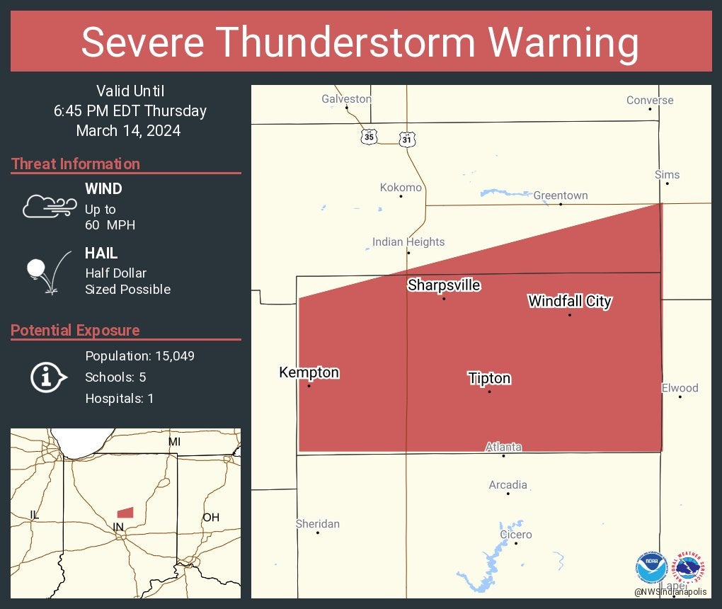
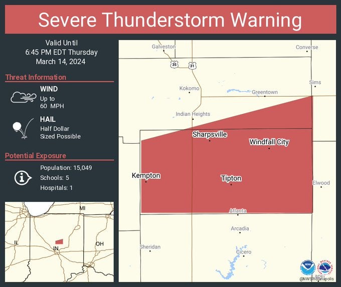
A severe thunderstorm warning was issued for Tipton County until 6:45 p.m. The storm contains 2-inch-diameter hail.
6:08 p.m.
A severe thunderstorm warning was issued for Tipton County and southeastern Howard County until 6:45 p.m. The storm contains large hail.
A severe thunderstorm warning was issued for northern Grant, southeastern Wabash and southwestern Huntington counties until 6:30 p.m.
6:06 p.m.
A severe thunderstorm warning was issued for northeastern Grant, southern Wells and southeastern Huntington counties until 6:30 p.m.
6:02 p.m.
A severe thunderstorm warning was issued for northern Boone and southern Tipton counties until 6:45 p.m. The storm contains golf ball-sized hail.
5:58 p.m.
A severe thunderstorm warning was issued for northeastern Grant, southern Wells and southern Miami counties until 6:30 p.m.
5:50 p.m.
A tornado warning was issued for northeastern Grant, southwestern Wells and southern Huntington counties until 6:15 p.m.
5:47 p.m.
A severe thunderstorm warning for southern Miami, southwestern Wabash and northwestern Grant counties until 6:15 p.m. Primary threats are winds up to 60 mph and quarter-sized hail.
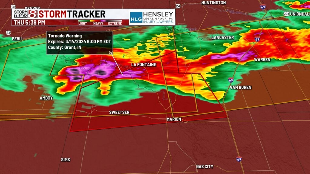
5:35 p.m.
Tornado warning for northern Grant and southern Wabash counties until 6:15 p.m. EDT. At 5:35 p.m. EDT, a severe thunderstorm capable of producing a tornado was located over Sweetser, or near Marion, moving east at 40 mph. Primary hazards were a tornado and quarter-sized hail.
5:21 p.m.
A tornado watch has been issued until midnight EDT Thursday and 11 p.m. CDT Thursday for most of central Indiana and parts of northern and southern Indiana.
Large Indiana cities in the watch area include Indianapolis, Fort Wayne, Lafayette, Muncie and Terre Haute.
Here is the list of Indiana counties in the watch from the National Weather Service’s Storm Prediciton Center in Norman, Oklahoma: Adams, Allen, Bartholomew, Blackford, Boone, Brown, Carroll, Cass, Clay, Clinton, Daviess, Dearborn, Decatur, Delaware, Fayette, Fountain, Franklin, Grant, Greene, Hamilton, Hancock, Hendricks, Henry, Howard, Huntington, Jackson, Jay, Jennings, Johnson, Knox, Lawrence, Madison, Marion, Martin, Miami, Monroe, Montgomery, Morgan, Orange, Owen, Parke, Putnam, Randolph, Ripley, Rush, Shelby, Sullivan, Tippecanoe, Tipton, Union, Vermillion, Vigo, Wabash, Warren, Wayne, Wells and White.
Tornado watches also were in effect for much of central Illinois and western Ohio.
A tornado touched down on Tuesday afternoon in Jefferson County, Indiana, Storm Track 8 has reported. That’s on the Ohio River about halfway between Louisville, Kentucky, and Cincinnati.
[ad_2]
Author

Related Posts

Metropolis organizations deal with teen gun violence
[ad_1] INDIANAPOLIS — Within the final week, Indianapolis has seen…

Man, 2 teens injured in Martinsville shooting
[ad_1] MARTINSVILLE, Ind. (WISH) — An adult and two juveniles…

Former Indianapolis Colt awarded Prevention Provider of the Year
[ad_1] Fight for Life Foundation founder and CEO, Marlin Jackson,…